AutoCAD Civil 3D
Design complex infrastructure with high accuracy — roads, bridges, drainage, and water management in a dynamic, interconnected model.
Civil 3D Applications & Use Cases
Road & Highway Planning
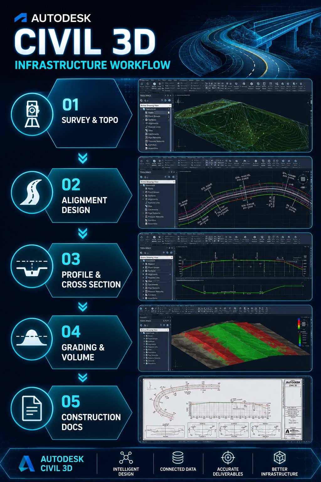
Road geometric design, horizontal & vertical alignment, and automatic cross-sections that update dynamically.
Drainage & Water Management
Hydrology & hydraulics analysis, drainage channel design, and integrated stormwater management systems.
Grading & Site Layout
3D terrain modeling, automatic cut-fill volume calculations, and visual site layout planning.
Survey & Mapping
Import field survey data, process point clouds, and automatically generate topographic maps.
Bridge Infrastructure
Design bridge structures integrated with the terrain model and dynamic road alignment.
Technical Documentation
Generate construction drawings, bill of quantities, and technical reports directly from the 3D model automatically.
Why Choose Civil 3D?
Dynamic, Auto-Updating Models
Changing one element (e.g. road alignment) automatically updates profiles, sections, and quantities — no manual redrawing.
InfraWorks Integration
Import Civil 3D models into InfraWorks for more comprehensive area visualization and more convincing presentations.
Collaboration for Civil 3D
Work on the same Civil 3D model simultaneously with teams in different locations — via Autodesk cloud.
Compatible with BIM 360 / ACC
Full integration with Autodesk Construction Cloud for end-to-end infrastructure project management.